The Paugussett Trail
 Every trail guide I’ve read calls out the length of the trail. Did you ever wonder how those measurements are taken?
We dropped cars at Indian Well State Park East Village Road in Monroe Indian Well Road
Update 3/19/2016 - Now a few years later, the Paugussett Trail has been extended about 10 miles south of Indian Well leading to Shelton Lakes. There's been a lot of great work by the Shelton Trails Committee to maintain and extend the trail. Check on the CFPA website or Shelton Conservation website for information.
Update 3/19/2016 - Now a few years later, the Paugussett Trail has been extended about 10 miles south of Indian Well leading to Shelton Lakes. There's been a lot of great work by the Shelton Trails Committee to maintain and extend the trail. Check on the CFPA website or Shelton Conservation website for information.
Our route took us from East Village Road Lake Zoar Housatonic River Indian Well State Park Boys Halfway River Cottage Street
 |
| Tricky crossing on Boys Halfway River |
The rest of the group was using this hike to begin training for a


 |
| Scenic Lake Zoar - a few more weeks it will be full of boat traffic |
After heading through a Mountain Laurel grove, the trail leads over 100-foot Ledge, a pass down though a rock cliff. Next, it heads into
 |
| Down the 100 Foot Ledge |
 |
| and across Round Hill Brook |
 |
| up the stairs, and into the neighborhood |
At last you’re back in the woods. The trail leads along and crosses Upper White Hill Brook just above a small waterfall. Careful on the crossing – you have to do a little hopping from boulder to boulder. Next stop is the Blue/Yellow blazed Vista Trail – a side trail from the Paugussett that leads steeply up to a hilltop with views down to the river (or a view if you stand in just the right spot and the trees haven’t filled in completely).
 |
| Housatonic River vista peaking through the trees. |


Stay on your own side Don't even think it!
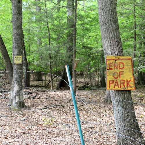
The last section of the Paugussett leads steeply down to Indian Well Road
 |
| Indian Well waterfall |
Back at the start, I said the trailhead is here at Indian Well. But the blue blazes do continue south. I took the trail down to the state park entrance road and across the street. The trail has been extended by the Shelton Trails Committee, linking up with the Shelton Lakes Greenway. I guess I'll have to find a map and hike these new miles before calling the Paugussett complete!
 |
| Next time, south out of Indian Well to wherever the trail takes us... |


A hoop skirt factory - imagine hiking in *that*! The Boys Halfway River *must* have a story :-)
ReplyDelete...and the Native American legend - well - Running Bear loved little White Dove ... :-)
Another dad doesn't like the boyfriend and bad things happen story. You'd think we would learn by now - but no!
ReplyDeleteThat's a nice write up Jim. I wonder what the variance is from the GPS to the wheelie thing? I've been on some walks that are way out in regards to the distance and I'm wondering how they were measured...
ReplyDeleteHey Greg - I didn't get the final tally, but the wheelie is so dependent on the operator and a little tricky over the rocks, boulders and river crossings. Halfway through the 9 miles (or so), the difference was almost a quarter mile. My guess is maps and guides will change quite a bit as GPS measurements replace what was done up until now.
ReplyDeleteEnjoyed this~ Always loved the Paugussett Trail!!
ReplyDeleteThis is a notice about the 6 mile extension to the Paugussett Trail.
ReplyDeletehttp://www.ctwoodlands.org/blue-blazed-hiking-trails/trail-notices/paugussett-trail-shelton-new-6-mile-trail-extension-complete
This is a Google map link: https://www.google.com/maps/d/viewer?ll=41.341247,-73.146286&t=m&source=embed&ie=UTF8&msa=0&spn=0.154658,0.205994&z=11&mid=zjXfbXb5_zTQ.kWyvUWukjozs
The trail now continues for about another five miles south to Buddington Road in Shelton. Our goal is to extend it to the Stratford town line along the Far Mill River, and Stratford then has the option to extend the trail through their park all the way to Rt 110.
ReplyDeleteThe trail now continues for about another five miles south to Buddington Road in Shelton. Our goal is to extend it to the Stratford town line along the Far Mill River, and Stratford then has the option to extend the trail through their park all the way to Rt 110.
ReplyDeleteThanks for the update Teresa. I'll have to check it out from Indian Well south next time I'm in town.
Delete