I had planned to hike the northern section of the Quinnipiac trail, but time was short so I settled on a shorter route – from Route 42 in Cheshire south around Mt Sanford, and then back north on the blue trail. A quick loop hike, moderate with some steep inclines, about 3½ miles taking just about an hour and a half.
The starting point was a small parking lot for the Quinnipiac Trail on
Bethany Mountain Road(Rt. 42) in
Cheshire, near the northern tip of the
Naugatuck State Forest. Hiked south into the woods, down and then over a bridge over Sanford Brook – two cut logs, a little bouncy and more encouragement to lose a little weight. Soon after the bridge, the trail splits with the blue/red blazed Sanford Alternate Trail heading east away from the Quinnipiac. This trail leads down into Nettleton’s Revine – a 14 acre property part of the
Cheshire Land Trust.
The
Sanford trail comes out of the woods onto an old camp road. You soon pass a dirt trail into a group camp area, with a signpost honoring George Cromie - former new haven city forester and strong advocate for forest maintenance. This was his land, where he experimented with planting different conifers along the trail as you see here. (Read the CFPA Connecticut Walk Book and you get a little history along with your trail maps.)
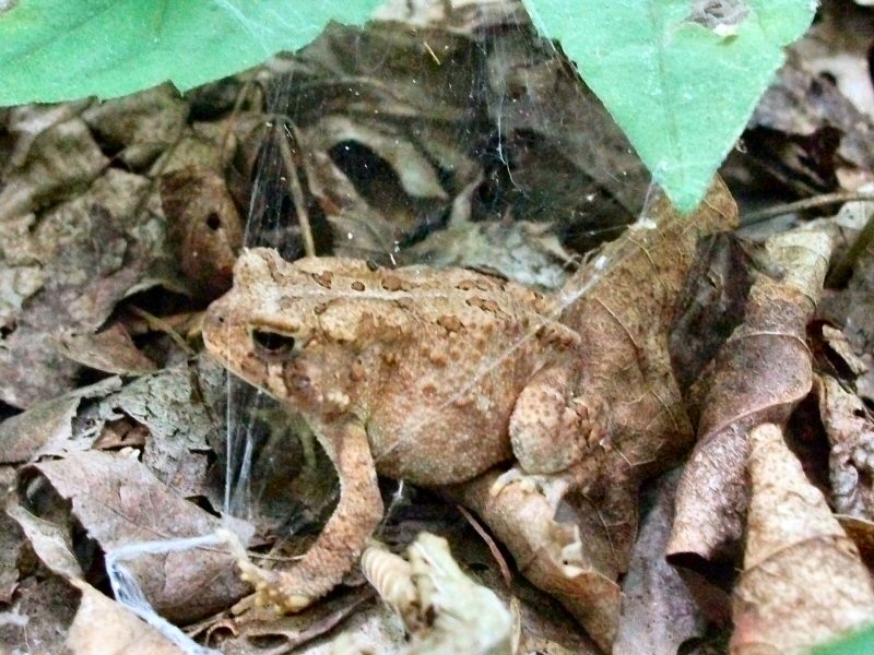
The forest was quiet – a few squirrels and chipmunks running through the leaves, and this toad hopping across the trail. Hiding in the leaves – good camouflage. Hiding under a spider web – not quite as effective.
 |
| Letterbox Trail Notes |
A little farther down the trail, the sounds of the forest are replaced by that of kids playing – the trail comes to the
YMCA's Camp Mountain Laurel. Summer camp is in full swing, swimming lessons, arts and crafts and a game of kickball on the ballfield. The
Sanford trail meets back up with the Quinnipiac Trail here, and I turned north to loop back. The trail does a couple of switchbacks up the south face of Mt Sanford. Up a moderate grade, the trail opens up to views west into Prospect. This isn’t the summit, but it’s good place to stop, take a break and enjoy the view. There’s a letterbox nailed to the tree nearby with some entries poetic and eloquent, others that might help explain why some species eat their young. And at least one hiker is a dog loving artist – who seems to travel with her own colored pencils.
The true summit is another quarter mile away, again with views off the cliff into Prospect. Hike down the mountain another ¾ mile, and you’re back at the
Sanford trail intersection. Back over the bridge, up the hill and back to the parking lot.
 |
| Boulder up to the Mt Sanford summit |
 |
| The view west into Prospect |
 |
| The Quinnipiac Trail heading back down Mt Sanford |


Comments
Post a Comment