Zoar Trail - Prydden Brook Trail
Last September I hiked the Zoar Trail in the Paugussett State Forest Lake Zoar
Now with the melted snow and early spring rains, it was worth another trip into the forest to see what the brook and falls were like. And voila, Prydden Falls:

I started the same route as my last trip – parking at the Great Quarter Road trailhead lot and hiking in along the lake. To be accurate, Lake Zoar Housatonic River Zoar

Instead of continuing on the Blue Trail passed the falls, I hiked west along the south bank of the brook. The trail isn’t marked – no painted blazes - but it is cleared and easy to follow. The brook was running fast, and there were small waterfalls all along the way. In one steep section, the trail crew built a stone stairway to protect the trail from erosion – it would be a waterslide otherwise.


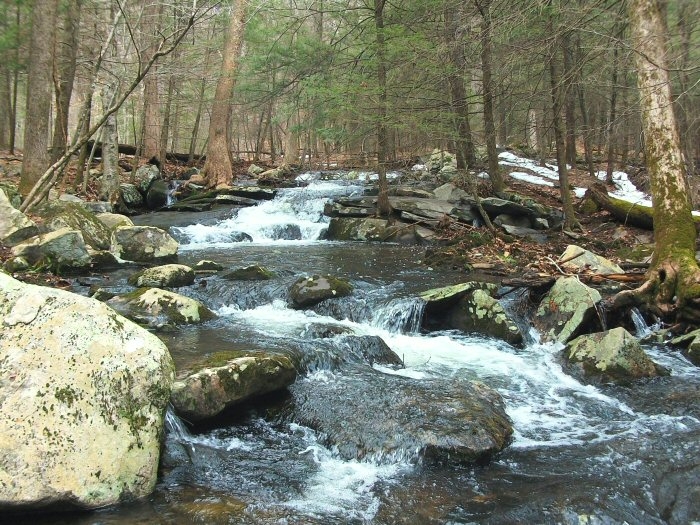
The brook crosses the blue trail again after about a half-mile, and I headed south again through the laurels and forest. There were spots where the trail was under water. I passed a couple of hikers bushwhacking to higher ground to avoid this swamped section – their sneakers would get a little soggy.
Watch that first step! Blue Trail Swamped section of the Blue Trail -
Crosses over Pryddon Brook Waders just might be required!


Along the way here, the Connecticut Walk Book indicates a scenic spot looking back toward the river. In September, when the leaves were still on the trees, I couldn't see much of anything. But now, you can peek through the trees for a view to the river below.

My shortcut along the brook cut a couple miles off the hike compared to covering the entire Zoar Trail. But it was a good way to kill a couple of hours that afternoon, and I got that picnic by the falls!


It was a great day for a picnic! Sounds like a great hike!
ReplyDeleteThe trail along Prydden Brook is quite scenic. I recommend descending on the Blue-Yellow Trail and walking up the trail on the south side for the best views of the cascades.
ReplyDeleteMap at http://www.ct.gov/deep/lib/deep/stateparks/maps/paugussettsouth.pdf