Posts

Showing posts with the label State Parks

Good Things, Small Packages - Southford Falls State Park

Image
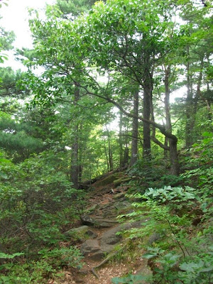
         Southford Falls State Park , Oxford , CT           State Park site                         Trail Map There are over a hundred state parks in little Connecticut , and beyond Sleeping Giant, I’ve only been to a few – those with miles of trails on their own or where one of the blue-blazed trails passes through.  At 120 acres, Southford Falls is one of the smaller parks. But I am a sucker for waterfalls, and when a photo group planned a shoot at Southford Falls , I had to check it out.  The falls are a beautiful photo spot, but don’t stop there.  The state park is a great place to spend some time and wander around.  The falls run on Eight Mile Brook as it flows from Lake Quassapaug to the Housatonic River .  If you're mapping it out, be careful to avoid wrong turns from the naming convention used out here - this ...

No Time to Hike?

Image
Are you in Connecticut?  Yes? - good.  Then get outside now!!  The weather is great (when it's not raining), good hiking temps, and the forests are exploding with Mountain Laurel - little pink or white flowers sparkling all over the place.  Get your friends, pack up the kids and get out there! No time to get out, you think?  Connecticut has more than 70 state parks and 30 state forests. Add the trails in municipal parks, preserves and utilities, and you're minutes from a hike almost anywhere in the state.   Come on out. Got an hour?  Take this little hike along the White Trail at Sleeping Giant State Park. Cross the bridge from the parking lot, onto the White Splash around in the stream a little Summer is almost here - Mountain Laurel in bloom Beautiful open woods After a night of heavy rain, even the trail is a stream. Look for little froggies hopping around the puddles.

Salmon River Trail

Image
Colchester CT 6.7 mile loop trail through the Salmon River State Forest and the Day Pond Brook State Park .      Trail Map                   Salmon River State Forest              Day Pond State Park The Salmon River Trail starts with a stroll across one of the last active covered bridges in Connecticut , the Comstock Bridge .  This photo is from a great site that chronicles the covered bridges in the state.  The bridge was built in the 1870’s for horse and buggy, and then pedestrian, traffic.  But here’s the state of the bridge today.  It was starting to sag and fail, and the great news is that instead of being replaced with a modern bridge, it’s being restored with much of the original material and design.  Expected completion next June.  You can catch up on the details here . 

Butterworth Brook Reservoir

Image
Have you been to Sleeping Giant State Park ?  I spent a long lunch there today, but not where you'd expect. Northwest across Tuttle Avenue, the Butterworth Brook property is not developed - no trails yet - but this time of year is really worth a look... Enter along Butterworth Brook

Macedonia Brook Trail - Kent, CT

Image
Sunny and 60 o – an absolutely beautiful morning in Kent .  The leaves are starting to turn – reds and yellows brighten the day.           State Park Website                                     Trail Map You couldn’t script a better start to the hike today.  Sound – babbling brook in the main park picnic area, wind rustling the leaves, a hawk screeches in the distance.  Cue the wildlife – three deer bolt off into the woods as the hawk circles overhead.  And action – start east up the hill on the Blue Trail in Macedonia State Park .  This 2300 acre state park has camping spring to fall, fishing and of course, hiking – seven marked trails including the 6.7 mile blue-blazed loop. 

Quinnipiac River State Park

Image
This section of the Quinnipiac Trail is a thru-hike from the trail head (and start of the Quinnipiac Trail) on Banton Street in North Haven, through the end of the park at Toelles Road, back into the woods ending at the entrance to Sleeping Giant State Park on Chestnut Lane in Hamden (total distance approx 6 miles). Update - as noted in one of the comments below, this part of the Blue Trail was closed and is no longer maintained by CFPA.   See their notice here.   The new southern end of the Quinnipiac Trail is Hartford Turnpike - so start here. State Park website         Get a copy of the Connecticut Walk Book West for a good trail map. Starting from the south, the trail begins along an old road - Banton Street - and then turns right into the woods toward the Quinnipiac river. It follows the river the rest of the way north. Imagine a trail meandering through forest and brush, maple stands and pine knolls, following the winding...

Back on the Giant

Image
It's been a few weeks since I was in Sleeping Giant Park, but it's a great day - humidity's down, a little breezy... - and I had some time to kill, so... From the main parking lot, I took the Orange trail to the Red Circle trail, then on to the Green trail back to it's start on top of the Giant's Chest.  The White, White/Blue and then Blue trails over to the Tower, and the Tower Path back down to the parking lot.  Just about 5 miles over a 2+ hour hike. Looking South from the Giant's Chest - Quinnipiac U, East Rock and New Haven While trails like the Blue and White take you across the tops of the ridges that make up Sleeping Giant, the Orange and Green run along the valleys between them.  The Orange heads up across the south side of the second ridge with views to East Rock and New Haven.  From the Green, you look up at the cliffs below the Tower, and make your way up to the Giant's Chest - great views west to the Giant's Chin and south past Quin...

Regicides Trail

Image
After hiking a piece of the trail last week, I figured I'd knock off the rest.  The Regicides Trail is a 7 mile spur of the Quinnipiac trail branching off between York Mountain in Hamden and West Rock in New Haven.  I arrived at the Wintergreen Avenue park entrance early - even earlier than the gate goes up!  My hike just got a mile or so longer than planned.  Normally, this time of year, the park road is open weekends so you can drive up to West Rock and Judges Cave, just not this early.  I walked up the entrance road to my 'starting point' the South Overlook. 7am and it's hazy already.  The normally clear view of New Haven and Long Island Sound was obscured and misty.  Looking east, I could just make out East Rock and the Soldiers and Sailors Monument.  To the northeast, Sleeping Giant was just a hazy watercolor image, darker hills floating in the white haze on the horizon.  The trail begins behind the park pavillion and winds it's ...

West Rock Ridge State Park

Image
... around Lake Wintergreen. I joined a New Haven Hiking Club hike Saturday at West Rock Ridge State Park, meeting at Lake Wintergreen.  I was early for the start, and waited at the lake watching kayaks launching out into the water, mountain bikers heading into the trails and families and dogs taking a walk in the woods.  Everyone was out trying to get some nice day in before the thunderstorms that were forecast later. Once everyone arrived, and signed in (and yes, I realize if I fall or twist an ankle or get lost in the woods it's my own problem and not the responsibility of the Hiking Club, hike leader, etc etc) we set off heading north on the Red Trail along Wintergreen Brook.  There were seven of us, with Gordon in the lead.  The trail was a level, easy walk along the stream and then into the woods.  At 2.7 miles, we turned west on Mountain Road, and then into the woods again taking the Yellow trail up the hill, where it meets the Regicides Trail....

Round Two

Time to start my summer Master's hikes - once again hiking all the blazed trails sometime between now and the beginning of fall.  This morning it was Blue trail up the Giant's Head, past the Tower, a quick turn at Red Circle onto the Violet trail back to the river, and then up the Red Diamond trail for a nice slow finish along the Mill River. And I took my own suggestions from the last time I hiked the Blue - kept it to two hours, only did part of the trail and I hiked up to the Chin from the quarry instead of down the other way.  And you know what? 

Happy Father's Day

Image
I took yesterday (Saturday) off.  And I mean really off.  I was so deep into the couch the cushions are just now starting to recover.  So this morning I woke up stiff and sore.  I either needed a sauna or, since it's nice and warm and humid, a hike in the woods.  Starting from Chestnut Lane, I had a good uneventful hike - Orange to Red Circle to Violet to Lost Vista to Blue then Orange back to the car.  Even starting at 8am the air was still and humid - it took about 10 feet to work up a sweat.  The 90 minute hike was great for loosening up sore muscles. Coming across the Violet trail, a favorite spot is just after the Red Circle trail heading east.  You start to climb a little, moving out from under the forest canapy into the pines.  There's kind of an 'ahhhhhhhh' moment when the woods clear and open to a northwest view. 

When the Giant blows his top, or maybe his knee

Image
...he was but an extinct volcano; he had been active in his time, but his fire was out, this good while, he was only a stately ash-pile now; gentle enough, and kindly enough for my purpose, without doubt, but not usable. A Connecticut Yankee in King Arthur's Court by Mark Twain When I think of an extinct volcano, I picture something like this - a mountain peak, maybe a flat top, but there's no question it looks like a volcano. Is there an extinct volcano on Sleeping Giant?  The area's mountains were formed by massive lava flows (the traprock), tipped up after a little fault here and there shuffled the landscape.  But can you find the mouth of a volcano?  There's a spot just off the White trail on the Giant's right knee.  It is a depression surrounded by boulders, filled with water during the spring, but drying out now.  Is it a volcanic crater? 

It's just a nice morning for a hike...

Image
My son was down from Boston, we took time for a little hike this morning - starting at the Tuttle Ave Red Circle trailhead, east over the horsetrail to the Red Square trail.  We took an unmarked trail off the Square.  It's on the park map as just a dotted line.  Maybe the Lost Vista trail I've heard of?  If so, the vista was lost behind the trees.  I'll check again in the winter - there should be good views north and east.

The Nature Trail

Image
How old it that pine tree?  Is that a hemlock, dogwood or oak tree? How does a tree grow on stilts? What's the difference between sandstone and trap rock? And what the heck is a tallus slope? Geology, botany, plant science, natural history...  and you just thought you were going on a hike this morning!

The Blue Trail

Image
or What Doesn't Kill You Makes You Stronger 6 miles, 3 hours. In my first blog entry, I said I'd been up and down the Giant many times, but I was sure there were trails I'd never been on.  Well, I have never been to this part of the park.  Started at Hartford Turnpike, a steady hike up away from the street.  The CFPA Blue Trail sign reminded me that these trails exist by the goodwill of landowners.  So let me say it right here - for anyone bordering the trails who allows their land to be used by me and countless other hikers, Thanks! Parallel Lines - trail through the trees Have you ever bought a "relaxation tape" with bird songs, and the sounds of gentle breezes?  Great.  Now picture that, hear that.  Do you feel relaxed?  That's what I heard, what I felt this morning...  It was going to be a nice hike. It was a half hour walk before I hit parts I recognized - crossing the yellow trail, the orange - knowing that meant the ...

The White Trail, Yellow Trail and center Yellow/Green connector

Image
6 miles, 3 hours. Describe the view of the Giant from the south.  After the head, you see the chest, the hip and leg, the knee, the foot...   the hills, peaks and ridges that make up the Giant's profile.  You know what else they have in common> they are the White Trail.  Up and then down the chest, up and then down the hip, along the leg, up and then down the knee... you get the idea.  This trail is a workout - sometimes hiking, sometimes hands, knees and feet climbing up the rock face.  But along the way are great views of the cliffs, and then Hamden, New Haven and the Sound to the south.