Posts

Showing posts with the label Circle

Walk by the Water

Image
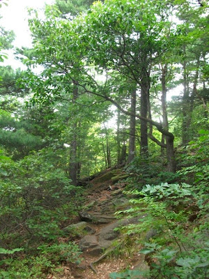
With a couple of hours to kill, I took what is one of my favorite hikes through Sleeping Giant Park.  Out on the quiet northern side of the mountain, parking at the Circle trailhead on Tuttle Ave, this little loop starts with a walk through horse country, a short uphill hike, and then a nice little wander by streams and waterfalls.  And since we're still drying out from string of storms that came through this summer, there's plenty of water running. I hiked along the horse path west from the parking area, past the pastures along Tuttle Ave.  Sections are pretty soggy where the water runs off the hills but doesn't quite drain out to the road.  Turn uphill at the Red Triangle trail.  This one leads up along a stream gorge - nice scenery but little water.  There is one steep and narrow section of the trail where it crosses the top of the gorge, but a fallen tree makes a good handrail to lean on.  Turn back east at the Violet trail...

One More Day on the Giant

Image
It's New England.  If you don't like the weather, wait a minute. The warm weather from the last few days gave way to howling winds and plummeting temperatures - back down anyway to the 20's and 30's where it belongs for January.  It's clear and sunny, and the last day of holiday before I go back to work tomorrow, so time for a little hike. You may have noticed photos from the last few days are trails at Sleeping Giant State Park.  I wrote an article for the Giant News - the association's newsletter.  The article was about being a Four Season Giant Master , hiking all the marked trails in the park in each season - spring, summer, fall and now finally winter.  On the off-chance the article is published in February's edition, I figure it's a good idea if I actually become  a Four Season Master by then.  Otherwise, my limited credibility as a writer suffers.  So I'm back on the Giant for the next few weekends pumping out the miles. ...

New Year's Day day after Hike

Image
As happens all too often here, a good snowstorm is followed quickly by warmer temperatures and at least a little rain.  That mucks up the trails as the surface thaws; mud and ice make a really slick track. With the thaw yesterday, and rain this morning, the planned walk along the river was cancelled - it would have been really wet and sloppy.  But there was still time for a little wander. After a hearty New Year's Eve celebration, I spent New Year's Day in a fog - and today the weather played the same trick.  Nothing changes the mood of a hike quicker than fog.  Even familiar trails get a little mysterious - scenery in the distance revealed a little at a time. With fog swirling around the valleys, the view off the cliffs make it look like I've been hiking above the clouds. And just as it started to rain again, back down at the foot of the hills.

Back on the Giant

Image
It's been a few weeks since I was in Sleeping Giant Park, but it's a great day - humidity's down, a little breezy... - and I had some time to kill, so... From the main parking lot, I took the Orange trail to the Red Circle trail, then on to the Green trail back to it's start on top of the Giant's Chest.  The White, White/Blue and then Blue trails over to the Tower, and the Tower Path back down to the parking lot.  Just about 5 miles over a 2+ hour hike. Looking South from the Giant's Chest - Quinnipiac U, East Rock and New Haven While trails like the Blue and White take you across the tops of the ridges that make up Sleeping Giant, the Orange and Green run along the valleys between them.  The Orange heads up across the south side of the second ridge with views to East Rock and New Haven.  From the Green, you look up at the cliffs below the Tower, and make your way up to the Giant's Chest - great views west to the Giant's Chin and south past Quin...

Round Two

Time to start my summer Master's hikes - once again hiking all the blazed trails sometime between now and the beginning of fall.  This morning it was Blue trail up the Giant's Head, past the Tower, a quick turn at Red Circle onto the Violet trail back to the river, and then up the Red Diamond trail for a nice slow finish along the Mill River. And I took my own suggestions from the last time I hiked the Blue - kept it to two hours, only did part of the trail and I hiked up to the Chin from the quarry instead of down the other way.  And you know what? 

Happy Father's Day

Image
I took yesterday (Saturday) off.  And I mean really off.  I was so deep into the couch the cushions are just now starting to recover.  So this morning I woke up stiff and sore.  I either needed a sauna or, since it's nice and warm and humid, a hike in the woods.  Starting from Chestnut Lane, I had a good uneventful hike - Orange to Red Circle to Violet to Lost Vista to Blue then Orange back to the car.  Even starting at 8am the air was still and humid - it took about 10 feet to work up a sweat.  The 90 minute hike was great for loosening up sore muscles. Coming across the Violet trail, a favorite spot is just after the Red Circle trail heading east.  You start to climb a little, moving out from under the forest canapy into the pines.  There's kind of an 'ahhhhhhhh' moment when the woods clear and open to a northwest view. 

When the Giant blows his top, or maybe his knee

Image
...he was but an extinct volcano; he had been active in his time, but his fire was out, this good while, he was only a stately ash-pile now; gentle enough, and kindly enough for my purpose, without doubt, but not usable. A Connecticut Yankee in King Arthur's Court by Mark Twain When I think of an extinct volcano, I picture something like this - a mountain peak, maybe a flat top, but there's no question it looks like a volcano. Is there an extinct volcano on Sleeping Giant?  The area's mountains were formed by massive lava flows (the traprock), tipped up after a little fault here and there shuffled the landscape.  But can you find the mouth of a volcano?  There's a spot just off the White trail on the Giant's right knee.  It is a depression surrounded by boulders, filled with water during the spring, but drying out now.  Is it a volcanic crater? 

It's just a nice morning for a hike...

Image
My son was down from Boston, we took time for a little hike this morning - starting at the Tuttle Ave Red Circle trailhead, east over the horsetrail to the Red Square trail.  We took an unmarked trail off the Square.  It's on the park map as just a dotted line.  Maybe the Lost Vista trail I've heard of?  If so, the vista was lost behind the trees.  I'll check again in the winter - there should be good views north and east.

The Waterfall Hike

Image
April 1, 2010 1 ½  Miles, 45 minutes Some days, I just need a quick nature-fix. This hike loops around from the Red Circle to Triange trail, across the Violet trail and back down the Circle trail. If you want a quick lunchtime walk, or a relaxing hike at the end of the day, this might the route for you. Park at the Circle trailhead on Tuttle Avenue (about 1 mile off Whitney Ave) and take the horse trail west to the red Triange trail. After all the rain the last few days, the horse trail was flooded in some spots, marshy in others, and crossed about five new streams that had formed. The Triangle trail is a steep hike up the hill - 350' ascent - along a stream for most of the way. If you lose the trail, just keep hiking up hill and keep the water within ear-shot. This is a small stream, but you'll pass a series of waterfalls on the way up. Turn east at the Violet trail and hike back across the park. The trail is fairly flat, and a nice walk beneath the ridge that ...

Red Triangle and Circle Trails

Image
3/20/2010 3¼ miles, 2 hours Sleeping Giant State Park Gorgeous morning for the next hike around Sleeping Giant.  Halfway up the 400' ascent, worthy of a mountain goat (granted, an old crippled one) the phone rings.  Yes, the phone - how else will I call for an air lift when I collapse?   "Is there an extra key on your keyring" the boy asks.  Why, yes there is!   "It's for the office, I need it to get into work." OK, back down the hill.  I started hiking to get a little exercise, so what's an extra mile, right?? These are the next two north-south trails, in roughly the center of the park.  A little tougher, they work their way up and then back down the mountain, peaking near 600’ feet elevation.  I entered the park at the south Triangle trailhead across from Hogan Road.  It’s a steep hike up to the White trail crossing, leveling out as it crosses the Tower Trail, and then an easy hike back down, exiting at Tuttle Ave.  The...