Posts

Showing posts from June, 2011

Along the way

Image
My favorite time of year hiking in southern Connecticut.  Well maybe second favorite, but it's a close second to fall. Not too hot, not too buggy, and the forests are filled with blooming Mountain Laurel. Even the power line corridors are all gussied up - this one along the road between the Reservoir section of the Mattabesett Trail and the Scovill Rock Loop Trail.  How's that for foreshadowing...

No Time to Hike?

Image
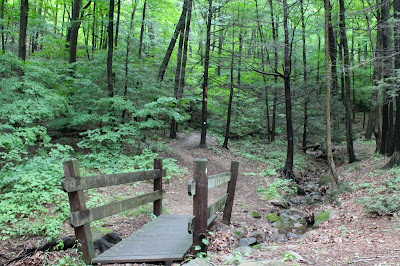
Are you in Connecticut?  Yes? - good.  Then get outside now!!  The weather is great (when it's not raining), good hiking temps, and the forests are exploding with Mountain Laurel - little pink or white flowers sparkling all over the place.  Get your friends, pack up the kids and get out there! No time to get out, you think?  Connecticut has more than 70 state parks and 30 state forests. Add the trails in municipal parks, preserves and utilities, and you're minutes from a hike almost anywhere in the state.   Come on out. Got an hour?  Take this little hike along the White Trail at Sleeping Giant State Park. Cross the bridge from the parking lot, onto the White Splash around in the stream a little Summer is almost here - Mountain Laurel in bloom Beautiful open woods After a night of heavy rain, even the trail is a stream. Look for little froggies hopping around the puddles.

Chauncey Peak and Lamentation Mountain

Image
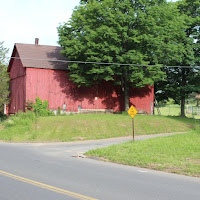
Mattabesett Trail – Middletown to the Berlin Turnpike trailhead in Berlin The trail has been rerouted since the 19 th edition of the WalkBook.  This link shows the new route. I've spent a lot of time on recent hikes down in the lowlands.  Granted, that’s about all you get in southern Connecticut (from the Indian word for flat land with many rivers *) but there is still the occasional walk along a hill or cliff.  This description in the Connecticut Walk Book sounded pretty good – “This almost level ridge is one of the most scenic traprock ridge walks in the state, offering spectacular views to the west, including Silver Lake and the Metacomet Ridge.”  I feel the need for a little altitude – even if it’s just a little. Red barn marks the turn on to Bell Street This 10 mile section of the Mattabesett Trail picks up where I left off at the Country Club Road trailhead north of Higby Mountain .  The hike starts with a 1.8 mile road walk, along Country Club Road , crossing

The Ever Expanding Universe

Image
There are about 825 miles of Blue-Blazed trails here in Connecticut, maintained by volunteers and overseen by the Connecticut Forest and Park Association. 825, until now. My copy of the CPFA News and Notes just came in the mail, and there's a new loop trail along the Connecticut River in Middletown - just inaugurated for Connecticut Trail Days.  The Scovill Rock Trail . So make that  826 ¾  miles.   And then there's the Paugussett Trail extension - once it's official it will add about three miles from Indian Well State Park down along the Shelton Lakes Trails... I've got some (more) walking to do...